Most Popular
🎓
One Year Post Graduate Professional Diploma in Geoinformatics
(GIS & Remote Sensing Technology)
🔹 Program Highlights:
- 8 Advanced Geospatial Technologies Covered
- 80–85% Practical Hands-on Training
- Live Interactive Classes with Recording Facility
- Live Project-Based Training
- 100% Placement Support
📍 Ideal For: Graduates aiming to build a strong professional career in GIS, Remote Sensing, and Geospatial Technologies.
⏱ 1 Year
🎓
Six Months Professional Diploma in Geoinformatics
(GIS & Remote Sensing Technology)
🔹 Program Highlights:
- 4 Advanced Geospatial Technologies Covered
- 4 Months of Comprehensive Training
- 2 Months of Hands-on Live Project Training
- Opportunity to Work on Real Live Projects
- 100% Placement Support
📍 Ideal For: Post Graduates, and working professionals who want to quickly build strong technical skills and start a successful career in GIS, Remote Sensing, and Geospatial Technologies.
⏱ 6 Months
🎓
Three Months Professional Certification in Any Two Technology
(GIS+RS)/(GIS+LiDAR)/(GIS+Digital Photogrammetry)
🔹 Program Highlights:
- 2 Advanced Geospatial Technologies Covered
- 1 Month of Hands-on Live Project Training
- 100% Placement Assistance
📍 Ideal For: Graduates, Post Graduates, job seekers, research scholars, and working professionals who want to quickly gain practical skills in GIS, Remote Sensing, LiDAR, Digital Photogrammetry technologies and enhance their career prospects in the Geospatial industry.
⏱ 3 Months
🛰️
Dual P.G. Diploma Program in Geoinformatics
(Industry + University Approved Program)
🔹 Program Overview:
The Dual P.G. Diploma Program in Geoinformatics is a uniquely designed dual-certification course that provides both academic recognition and industry validation. This integrated approach ensures strong professional credibility and enhanced career opportunities in the rapidly growing geospatial sector.
🔹 Program Highlights:
- Industry-Approved Professional Diploma
- University-Approved Academic P.G. Diploma
- Advanced Geospatial Technologies Covered
- 80–85% Practical Hands-on Training
- Live Project-Based Learning
- Pan-India Valid Certification
- 100% Placement Support
📍 Ideal For: Graduates who want both a recognized university qualification and an industry-approved professional certification to strengthen their career prospects in GIS, Remote Sensing, Surveying, Mapping, and Geospatial Technologies.
⏱ 1 Year
📐
One Month Professional Certificate Program
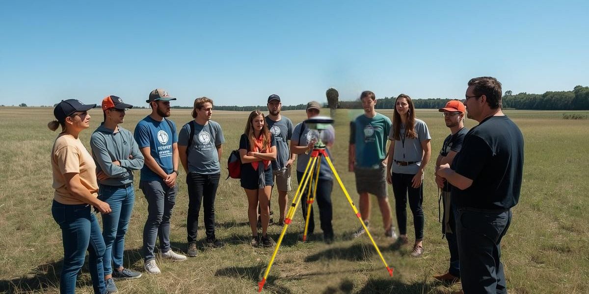
(GIS / Remote Sensing / Photogrammetry / LiDAR / Surveying)
🔹 Program Overview:
The One Month Certificate Program is an intensive, skill-focused training designed to provide practical exposure in specialized geospatial domains. The program can be customized based on student, institutional, or corporate requirements, ensuring targeted learning outcomes within a short duration.
🔹 Program Highlights:
- Choice of Specialization: GIS / Remote Sensing / Photogrammetry / LiDAR / Surveying
- Industry-Oriented Customized Curriculum
- 70–80% Practical Hands-on Training
- Latest Software & Tools Training
- Flexible Mode (Online / Offline / Hybrid)
📍 Ideal For: Students, research scholars, working professionals, government officials, and corporate teams who want to upgrade their technical skills in a short period with focused, practical learning.
⏱ 1 Month
New Batch
🏢
Corporate Training Program
(For Working Professionals & Organizations)
🔹 Program Overview:
Our Corporate Training Program is specially designed for working professionals, government departments, PSUs, and private organizations seeking to upgrade technical expertise in Geospatial Technologies. The training is practical, customized, and aligned with real industry requirements.
🔹 Program Highlights:
- Customized Curriculum Based on Organizational Needs
- Advanced Training in GIS, Remote Sensing, LiDAR, Photogrammetry & Surveying
- Hands-on Practical Sessions with Real-Time Data
- On-site / Online / Hybrid Training Modes
- Industry-Experienced Certified Trainers
- Flexible Scheduling for Working Professionals
- Corporate Certification & Skill Assessment
📍 Ideal For: Working professionals, engineers, planners, surveyors, researchers, and technical teams who want to upgrade their skills, improve productivity, and stay competitive in the evolving geospatial industry.
⏱ Flexible